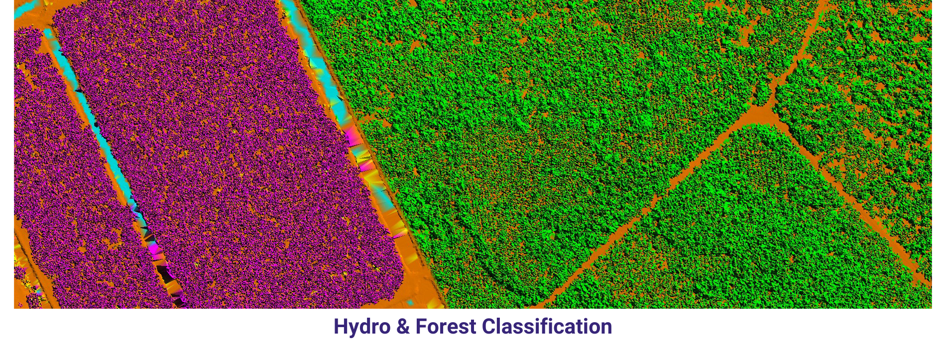
AAMGST has strong comprehensive hold on LiDAR processing of Airborne, Terrestrial and Mobile data. LiDAR data has been classified and vectorized from various scanners (Leica, RIEGLand Optech) for different applications.
We have delivered one million hectors with high quality and reliable data to our Poland and US clients. We have technically exceptional and challenging LiDAR technicians to meet project deadlines. Our quality-driven LiDAR processing methodologies assures you high quality and fast turnaround.
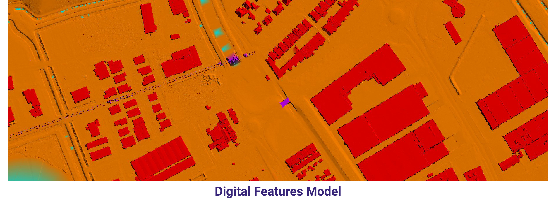
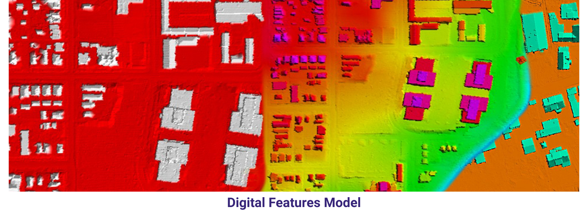
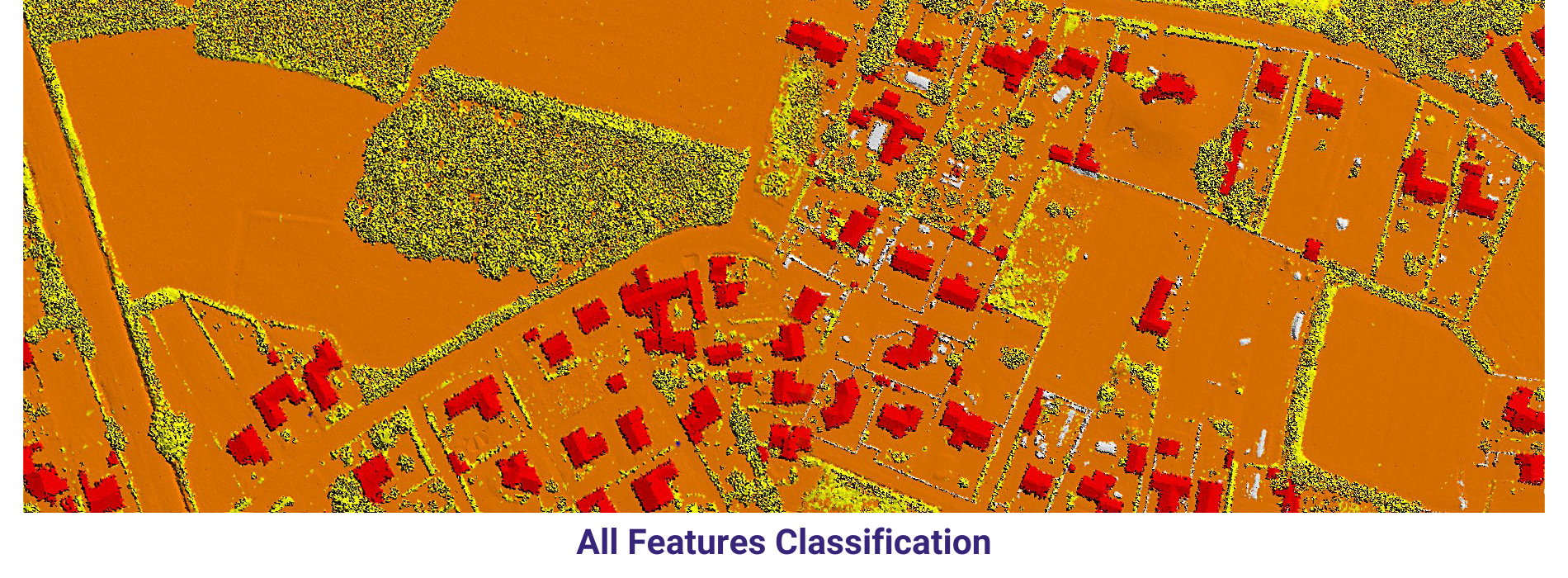
Airborne LiDAR Classification
Airborne LiDAR data for urban area with point density 20 has been classified into their respective classes. Final output of DTM and DSM were generated and submitted to client in ESRI grid format.
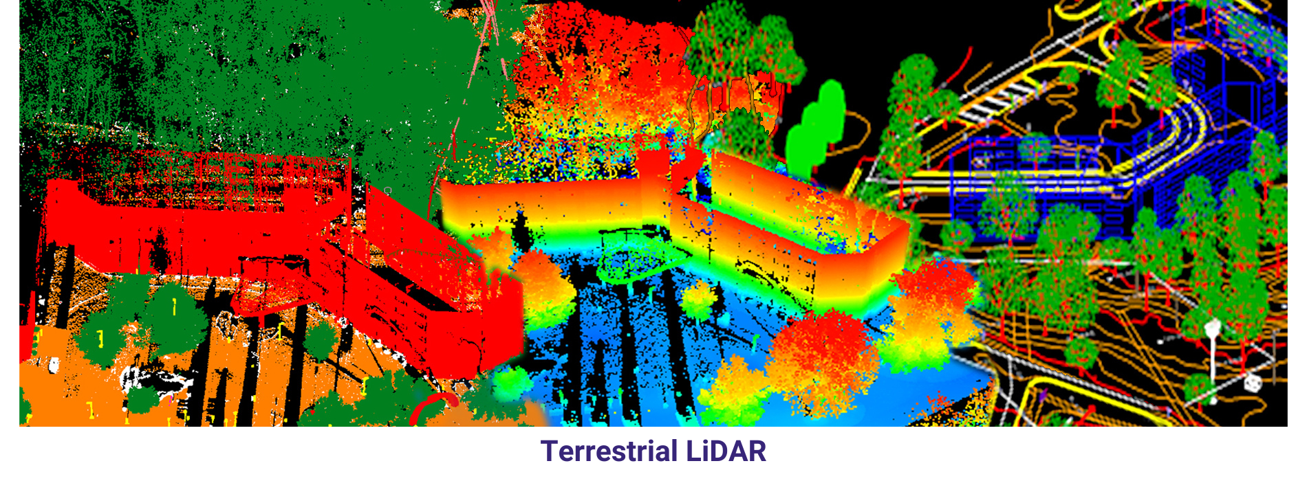
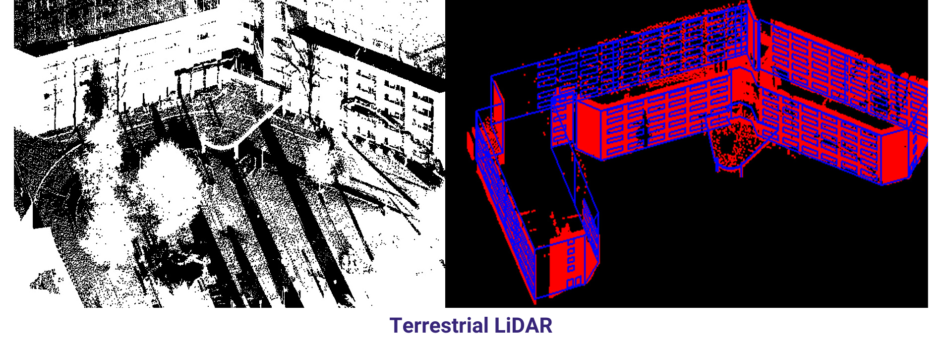
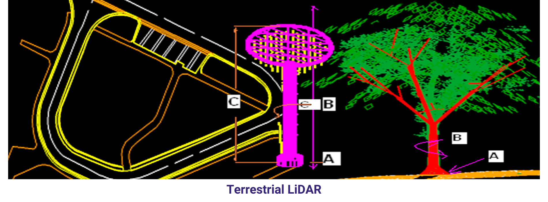
Terrestrial LiDAR
3D Topographic Mapping from Riegl VZ 4W scanner, Automatic classification carried out to classify different features as per the specification like buildings, trees, utilities and further classified manually.
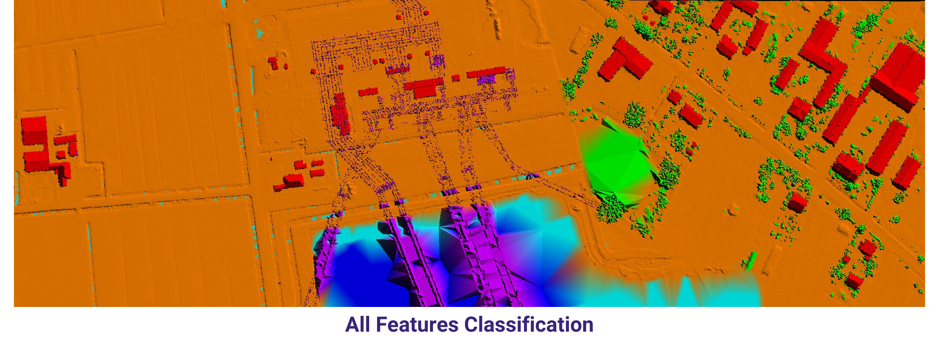
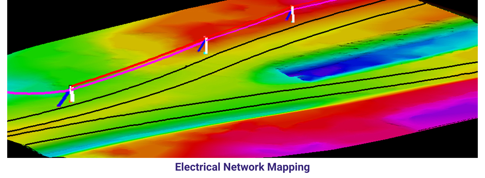
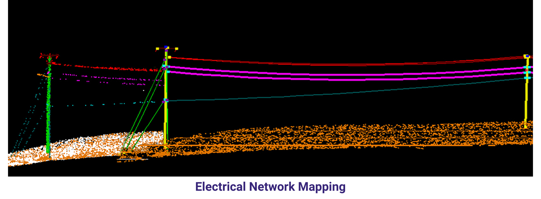
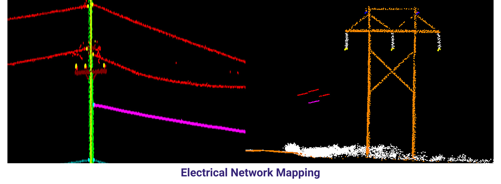
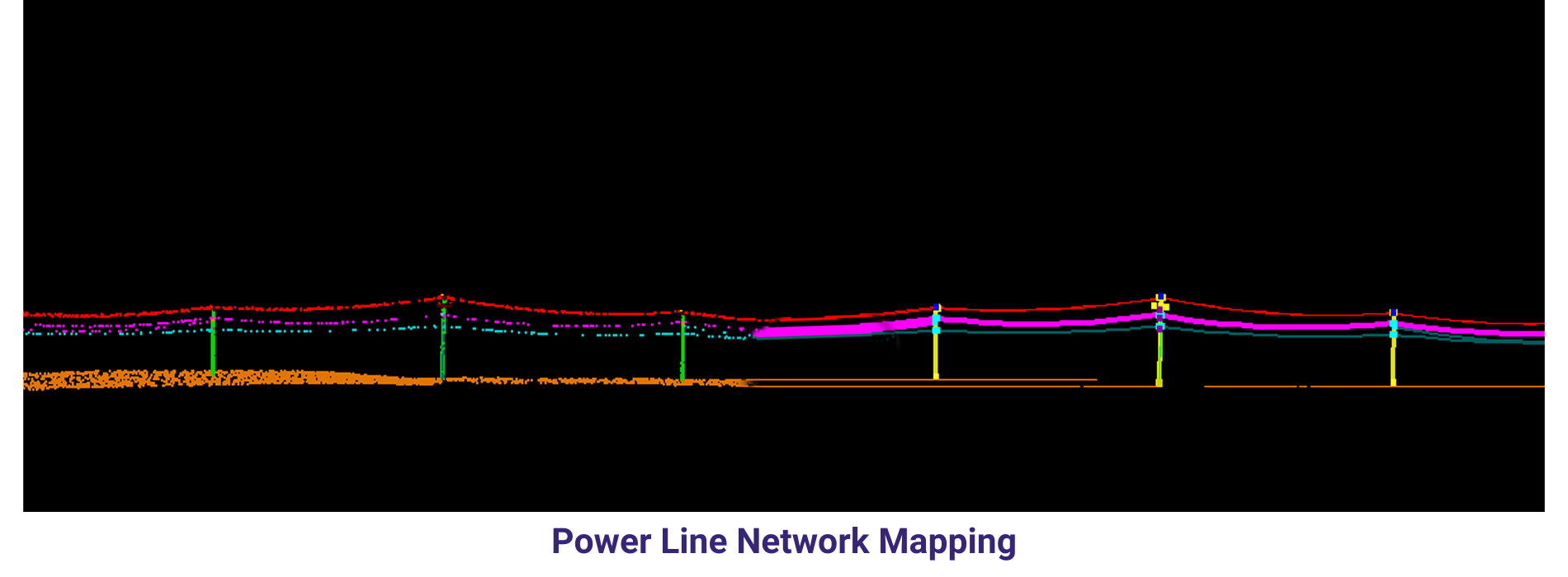
Mobile LiDAR
Power line Corridor mapping from Electrical utilities have been vectorized poles, pole – features, Guy wires, power line, and Secondary line were manually classified into their respective classes.
LiDAR, or Light Detection and Ranging, is a remote sensing technology that uses laser pulses to measure distances and create 3D representations of the Earth’s surface. LiDAR data processing in GIS (Geographic Information Systems) plays a crucial role in various industries such as urban planning, forestry management, and disaster response. One of the key steps in LiDAR data processing is data classification, which involves grouping LiDAR points into different categories based on their characteristics, such as ground points, vegetation points, and building points.
Another important aspect of LiDAR data processing is feature extraction, which involves identifying and extracting specific features from the LiDAR data. This includes extracting attributes such as tree heights, building heights, and road widths, which can be used for various applications such as flood risk assessment and urban infrastructure planning. LiDAR data can also be processed to create digital terrain models (DTMs) and digital surface models (DSMs), which provide detailed information about the elevation and morphology of the Earth’s surface.
In addition to data classification and feature extraction, LiDAR data processing also involves data visualization and analysis. By visualizing LiDAR data in GIS software, analysts can gain a better understanding of the topography and features of a given area. Furthermore, by overlaying LiDAR data with other geospatial datasets such as satellite imagery and land cover data, analysts can perform advanced analyses and generate valuable insights for decision-making. Overall, LiDAR data processing in GIS is a powerful tool that enables the extraction of valuable information from LiDAR data, leading to informed decision-making and improved planning in various industries.