We are herewith sending the Cartography projects which we have been executed recently. We have successfully completed many 3D cartographic projects of different scales (1:500, 1:1000, 1:2000, 1:5000, 1:10000) from various sensors like Aerial Frame, Digital. Digital Cartographic rules and systematic in-house quality check procedure have been followed while making these maps in order to meet the client specifications. We have produced multi-scale maps for various purposes and with content from different countries and communities.
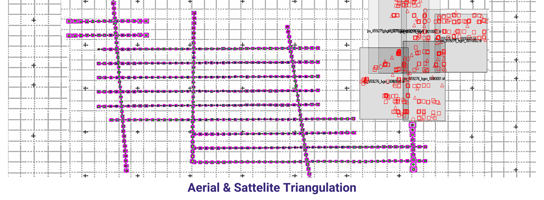
Satellite Imageries
The term “satellite aerial triangulation” is a bit of a misnomer because aerial triangulation traditionally refers to the process of triangulating ground points from overlapping aerial photographs captured by aircraft. However, satellite imagery can also be used in a similar process, but it’s typically referred to as satellite image triangulation or simply image triangulation.
In this context, satellite image triangulation involves establishing accurate ground positions of points visible in overlapping satellite images by measuring the angles between them from multiple satellite perspectives. This process is similar in principle to aerial triangulation but is applied to satellite imagery captured by remote sensing satellites orbiting the Earth.
Satellite image triangulation is commonly used in remote sensing applications for mapping, land surveying, environmental monitoring, and other geospatial tasks. It enables the generation of orthorectified satellite images, digital elevation models (DEMs), and other geospatial products that are essential for various applications in the geospatial industry.
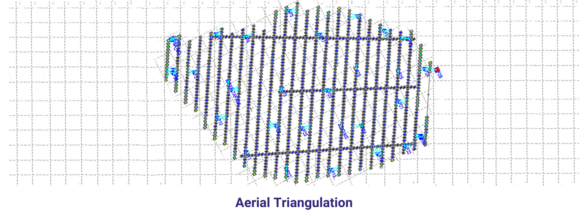
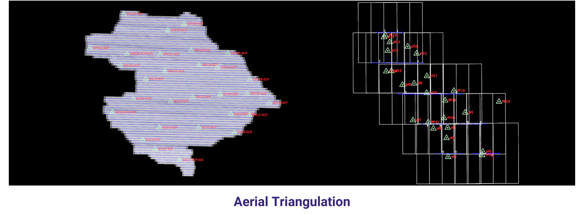
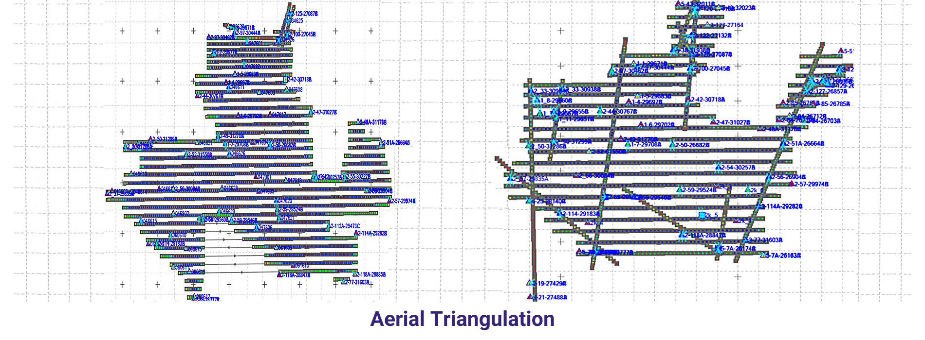
Aerial Images
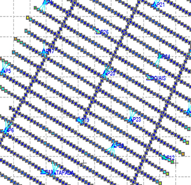
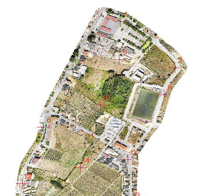
Aerial triangulation (AT) is a photogrammetric technique used to establish accurate ground positions of points visible in overlapping aerial images captured by aircraft. It involves measuring the angles between these points from multiple camera perspectives, then using trigonometric principles to calculate their 3D coordinates on the Earth’s surface.
Aerial triangulation is a fundamental step in the photogrammetric workflow for generating orthophotos, digital elevation models (DEMs), and other geospatial products from aerial imagery. It plays a crucial role in mapping, surveying, urban planning, infrastructure development, and environmental monitoring applications, where accurate spatial information is essential for decision-making and analysis
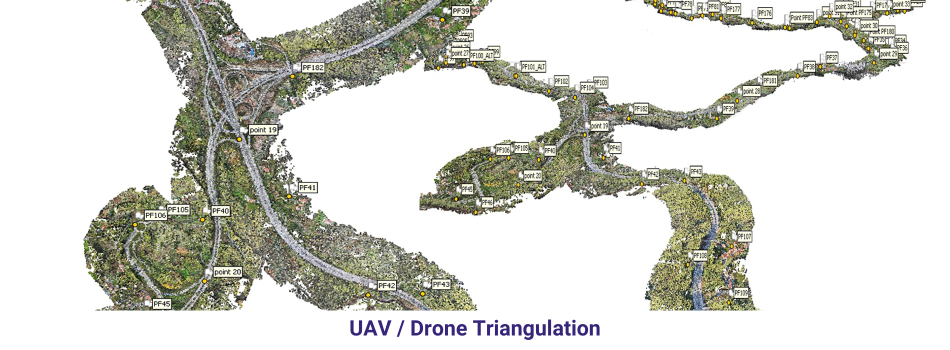
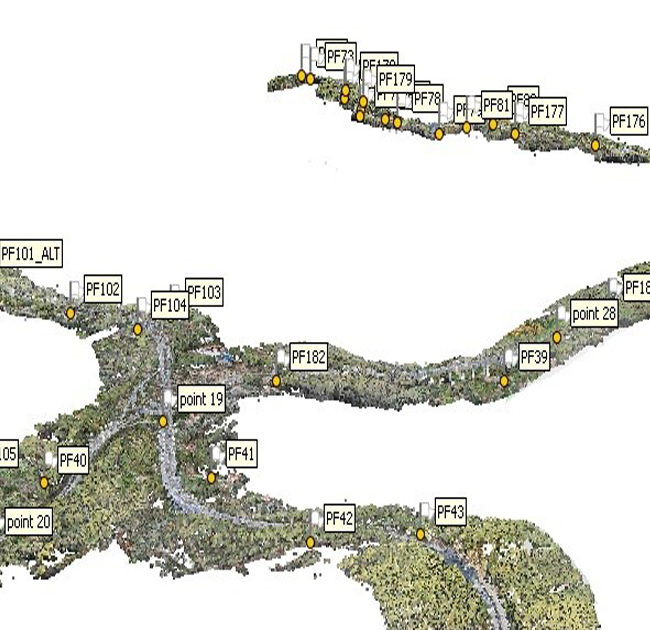
UAV/Drone Images
Drone triangulation, also known as UAV triangulation or aerial triangulation using drone imagery, refers to the process of establishing accurate ground positions of points visible in overlapping images captured by drones equipped with cameras. This process is similar to traditional aerial triangulation but is adapted to the characteristics and capabilities of drone-based imagery.
Drone triangulation is commonly used in various applications, including mapping, surveying, 3D modeling, construction site monitoring, agriculture, environmental assessment, and infrastructure inspection. It offers advantages such as flexibility, rapid data acquisition, cost-effectiveness, and accessibility, making it an increasingly popular choice for geospatial data collection and analysis.
Direct Georeferencing
Direct georeferencing is a technique used in photogrammetry and remote sensing to determine the precise position and orientation of an imaging sensor (such as a camera) directly from onboard navigation and positioning sensors, without the need for ground control points (GCPs). This method relies on integrating Global Navigation Satellite System (GNSS) receivers, Inertial Measurement Units (IMUs), and optionally other sensors to provide accurate positioning, attitude (orientation), and velocity information for the imaging platform.
Direct georeferencing is commonly used in UAV (drone) mapping, aerial photogrammetry, mobile mapping systems, airborne LiDAR, and other applications where accurate and efficient georeferencing of sensor data is required.