Speed: When it comes to surveying, mobile mapping is far faster than traditional approaches. As per research conducted by the Association for Project Management (APM), this method has the potential to scan data 40 times faster than conventional static scanning instruments like tripods.
Effectiveness: Mobile mapping tools increase the effectiveness of your scans. Using mobile mapping devices lets you work faster and on more projects with your current staff when working on major projects with tight budgets and deadlines. Because of this, it is much more economical.
Flexibility: Including a Mobile Mapping System in your product line allows you to combine various speeds and data quality combinations with clients, giving you greater negotiation leverage when it comes to pricing. Ultimately, the consumer could select the accuracy level that best suits their requirements.
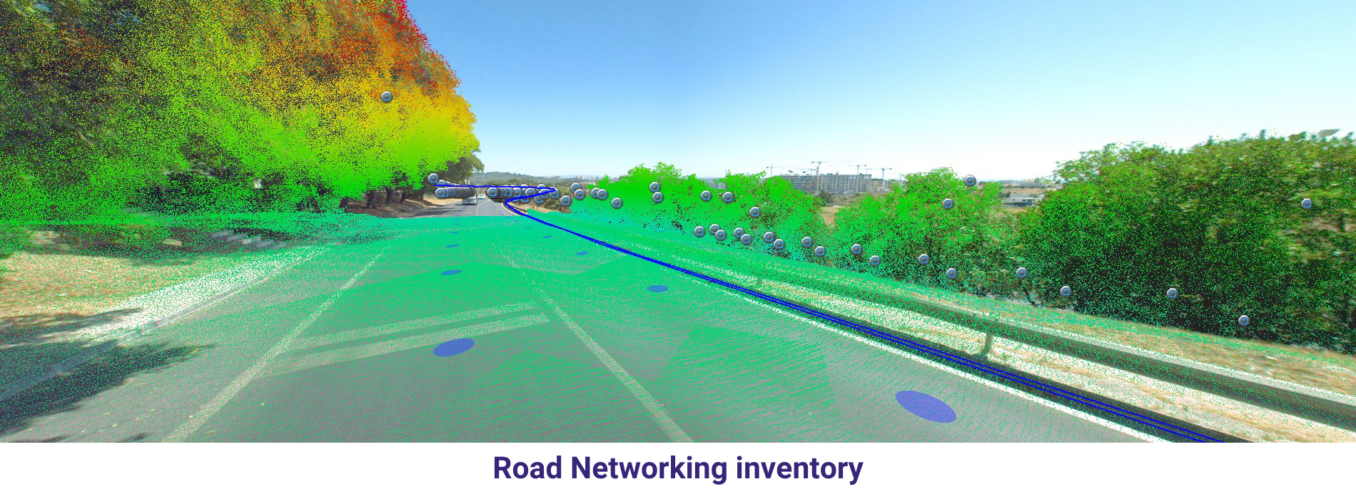
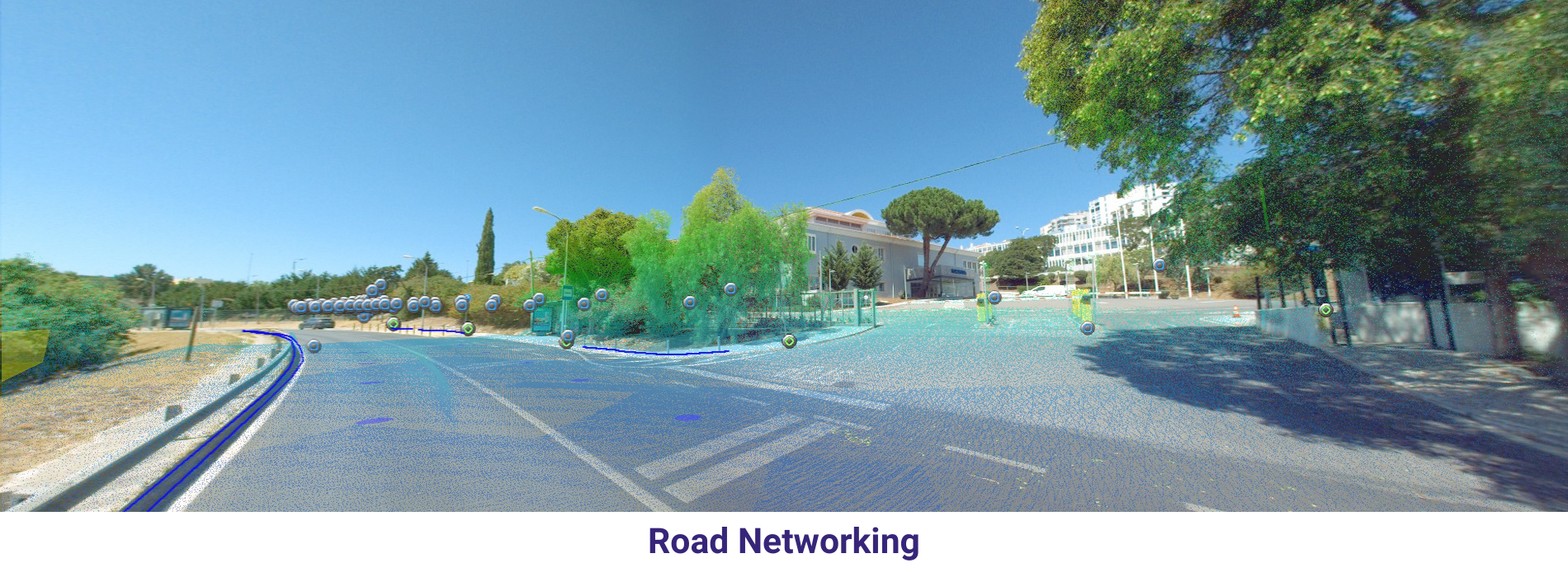
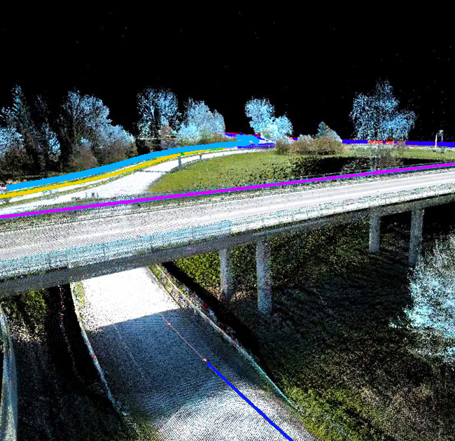
Vehicle-based Mobile Mapping Systems
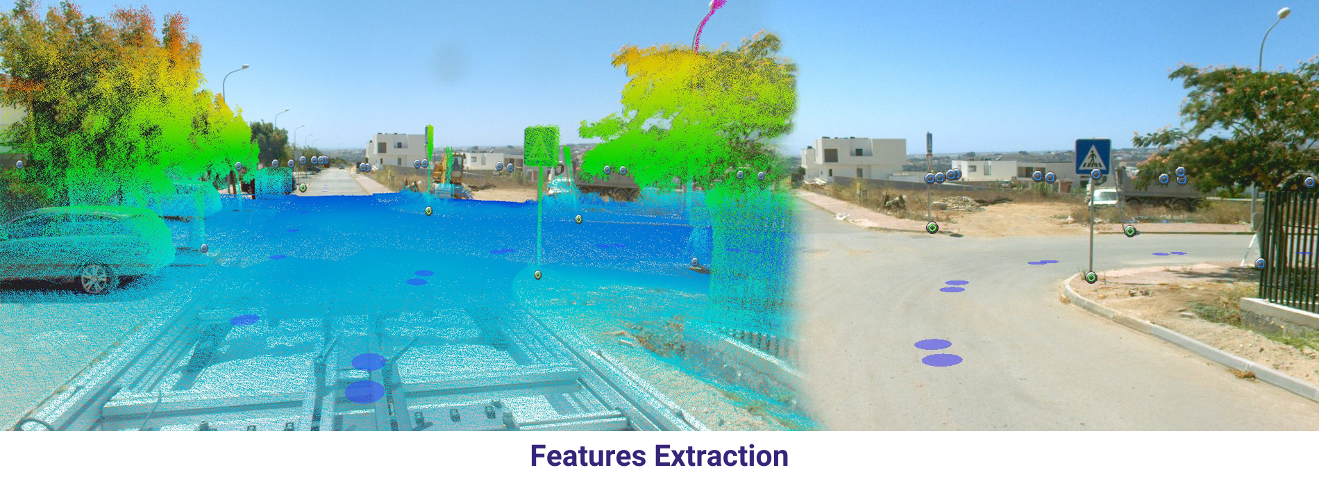
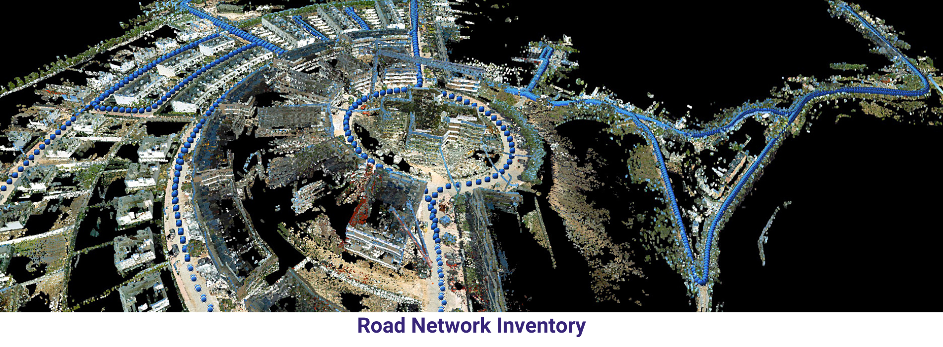
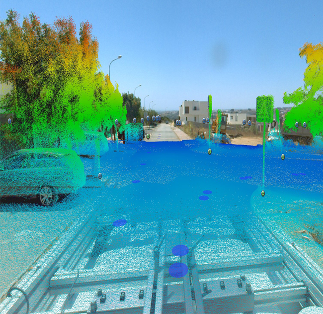
Vehicle-based Mobile Mapping Systems (MMS) are specialized platforms mounted on vehicles equipped with a variety of sensors and imaging systems. These systems collect geospatial data while the vehicle moves through an environment, capturing information about the surrounding area in real-time or near-real-time.
Vehicle-based MMS offers a versatile and efficient solution for collecting detailed geospatial data over large areas, providing valuable information for various industries and applications. Their ability to capture high-resolution imagery and 3D point clouds while moving through an environment makes them essential tools for mapping, surveying, and asset management projects.
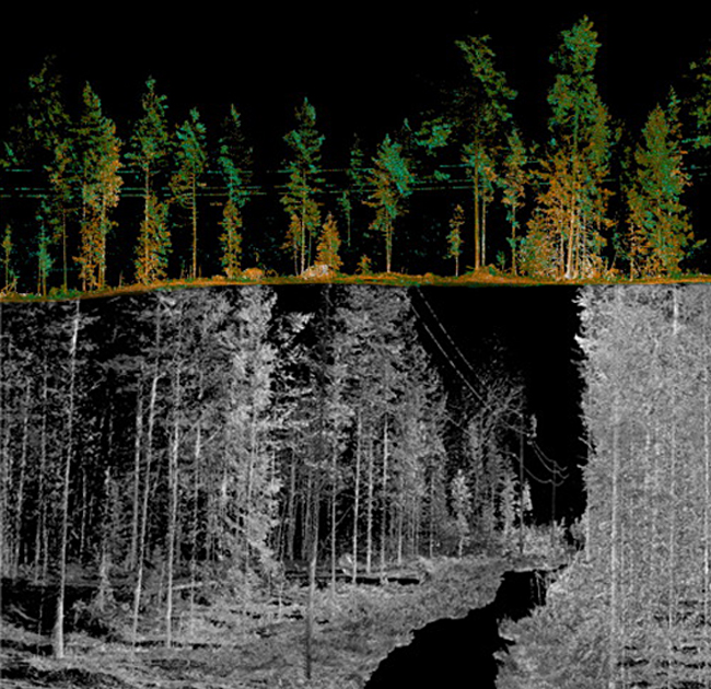
Rail-based Mobile Mapping Systems
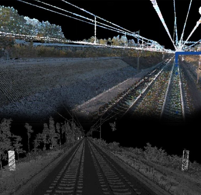
Rail-based Mobile Mapping Systems (MMS) are specialized platforms mounted on rail vehicles, such as locomotives or railcars, equipped with sensors and imaging systems. These systems are used to collect geospatial data while the rail vehicle traverses railway networks, allowing for mapping and assessment of rail infrastructure and adjacent areas.
Rail-based MMS offer a comprehensive solution for collecting detailed geospatial data along railway networks, supporting maintenance, planning, and management activities in the rail industry. By capturing accurate 3D information about rail infrastructure and adjacent areas, these systems help improve safety, efficiency, and reliability in railway operations.
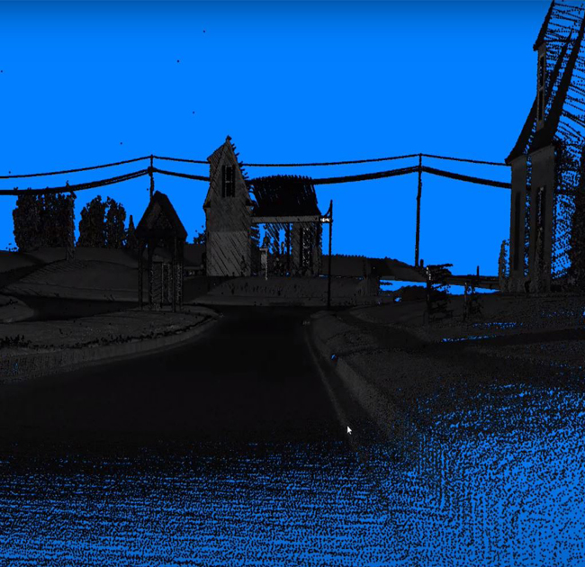
Boat-based Mobile Mapping Systems
Boat-based Mobile Mapping Systems (MMS) are specialized platforms mounted on boats or vessels equipped with sensors and imaging systems. These systems are used to collect geospatial data while the boat navigates water bodies such as rivers, lakes, and coastlines. Boat-based MMS capture information about bathymetry, shoreline features, and underwater terrain, supporting hydrographic surveying, navigation charting, and coastal zone management.
Boat-based MMS offer a comprehensive solution for collecting detailed geospatial data in aquatic environments, supporting a wide range of marine and coastal applications. By capturing accurate information about bathymetry, shoreline morphology, and underwater features, these systems contribute to safe navigation, environmental protection, and sustainable management of marine resources.
Drone-based Mobile Mapping Systems
Drone-based Mobile Mapping Systems (MMS) are specialized platforms mounted on unmanned aerial vehicles (UAVs) or drones equipped with sensors and imaging systems. These systems are used to collect geospatial data from the air while the drone flies over a target area, allowing for mapping and assessment of terrain, infrastructure, and environmental features.
Drone-based MMS offer a flexible and cost-effective solution for collecting geospatial data over small to medium-sized areas. By capturing high-resolution imagery and 3D point clouds from the air, these systems provide valuable information for mapping, analysis, and decision-making in diverse fields.
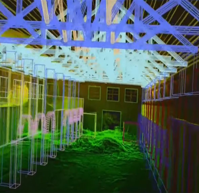
Backpack-based Mobile Mapping Systems
Backpack-based Mobile Mapping Systems (MMS) are portable and lightweight platforms equipped with sensors and imaging systems designed to be carried by individuals or operators on foot. These systems enable data collection in areas inaccessible to traditional vehicles or drones, such as pedestrian zones, narrow streets, indoor environments, and rough terrain.
Backpack-based MMS offer a portable and versatile solution for collecting geospatial data in areas where traditional vehicles or drones cannot access. By enabling data collection on foot, these systems provide valuable information for mapping, analysis, and decision-making in diverse fields and environments.
Handheld Mobile Mapping Devices
Handheld Mobile Mapping Devices are compact, portable systems equipped with sensors and imaging capabilities designed to be carried by individuals or operators on foot. These devices enable rapid data collection in both indoor and outdoor environments, including areas inaccessible to traditional vehicles or drones.
Handheld mobile mapping devices offer a flexible and user-friendly solution for collecting geospatial data in diverse settings. By enabling data collection on foot, these devices provide valuable information for mapping, analysis, and decision-making in various industries and applications.