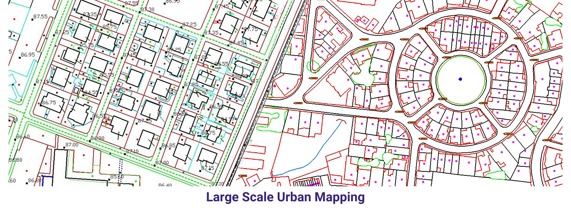
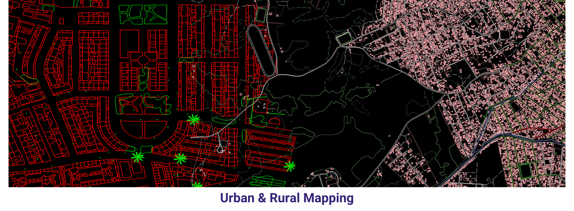
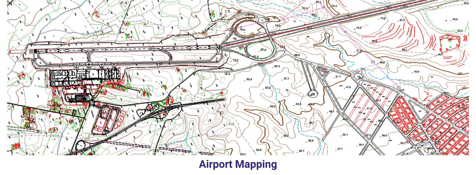
We are herewith sending the Cartography projects which we have been executed recently. We have successfully completed many 3D cartographic projects of different scales (1:500, 1:1000, 1:2000, 1:5000, 1:10000) from various sensors like Aerial Frame, Digital. Digital Cartographic rules and systematic in-house quality check procedure have been followed while making these maps in order to meet the client specifications. We have produced multi-scale maps for various purposes and with content from different countries and communities.
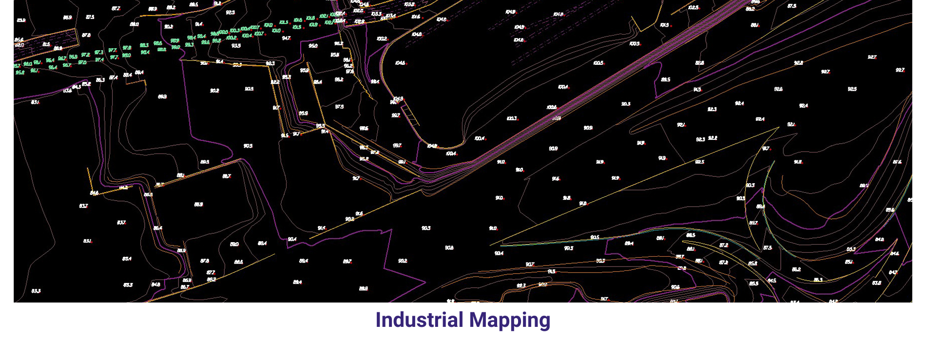
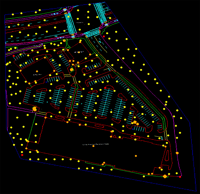
Industrial Mapping
Industrial mapping involves creating detailed representations of industrial facilities, including manufacturing plants, refineries, warehouses, and other industrial infrastructure.
By following these steps, you can create a comprehensive and informative map of an industrial facility that serves as a valuable tool for facility management, operations planning, safety compliance, and environmental stewardship.
Hydrographic mapping
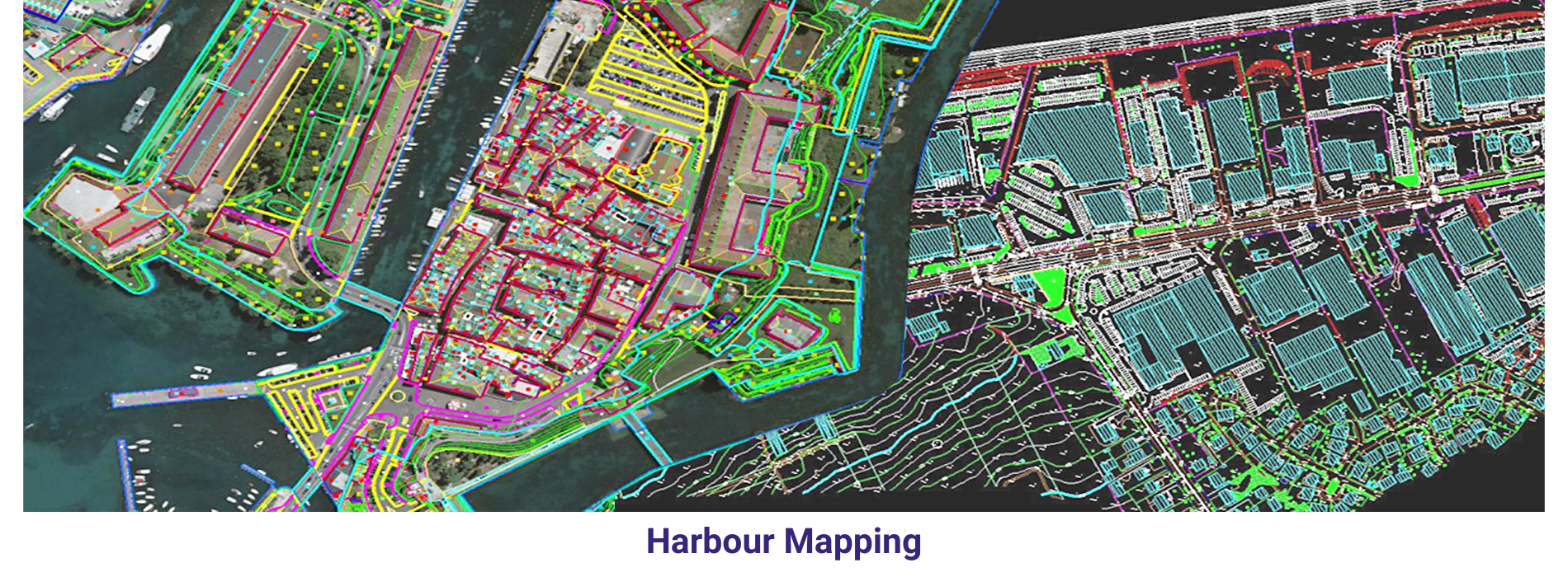
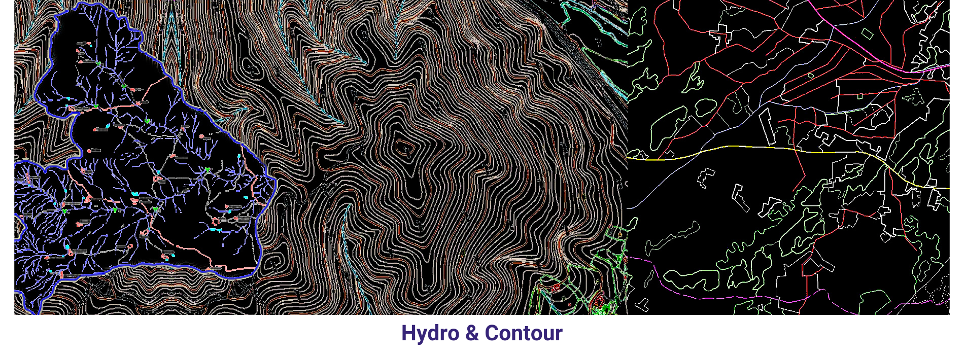
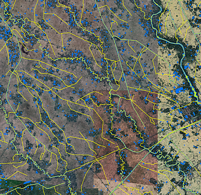
Hydrographic mapping involves the systematic surveying and mapping of bodies of water, including oceans, lakes, rivers, and other waterways, as well as the surrounding coastal areas and underwater features. These maps provide valuable information for navigation, maritime safety, resource management, environmental monitoring, and scientific research.
Hydrographic mapping is essential for ensuring the safety of maritime navigation, protecting marine ecosystems, managing coastal resources, and supporting scientific research in oceanography and marine geology. By providing accurate and up-to-date information about underwater terrain and coastal features, hydrographic maps help reduce the risk of accidents at sea, optimize shipping routes, and facilitate the sustainable use of marine resources.
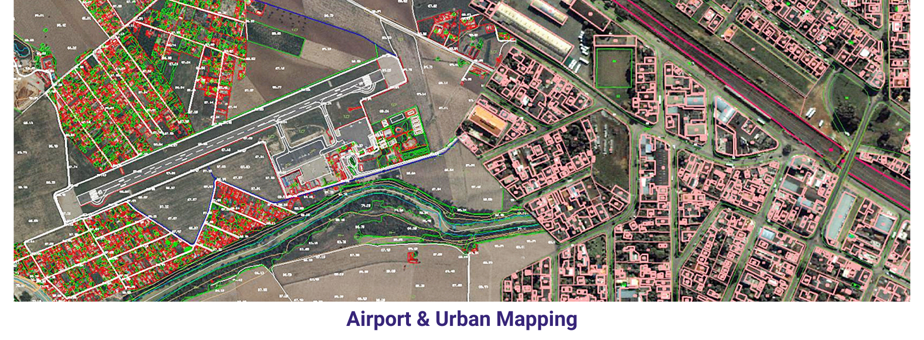
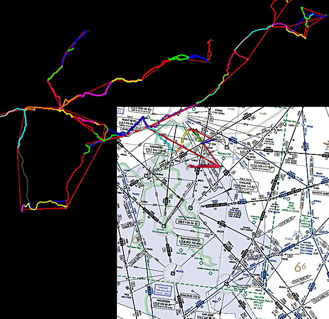
Navigation and aeronautical mapping
Navigation and aeronautical mapping involve the creation of maps and charts specifically designed for air and sea navigation. These maps provide crucial information for pilots, sailors, and other navigators to safely traverse through airspace and waterways.
Both navigation and aeronautical mapping are essential for ensuring the safety and efficiency of air and sea transportation, as well as for supporting emergency response, search and rescue operations, and maritime and aviation commerce. These maps are continually updated to reflect changes in navigation infrastructure, airspace regulations, and environmental conditions, thereby providing accurate and reliable information for navigators and aviators.
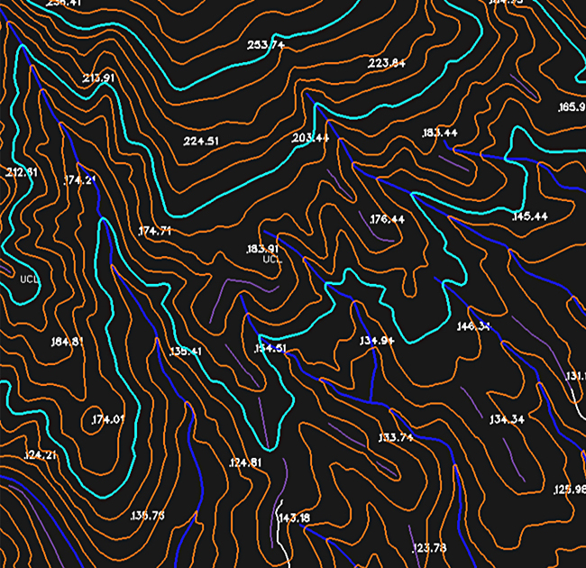
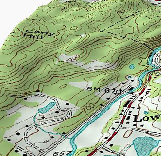
Isopleth or Contour Maps
Isopleth maps, also known as contour maps or isoline maps, are a type of thematic map that represents continuous spatial phenomena by connecting points of equal value with contour lines. These lines join areas of the map that have the same value for the variable being mapped, such as elevation, temperature, rainfall, or pollution levels.
Isopleth maps are widely used in geography, meteorology, geology, environmental science, and other fields to visualize and analyze continuous spatial phenomena. They provide insights into spatial patterns, gradients, and variations in the data, allowing viewers to interpret and understand the spatial characteristics of the variable being mapped.
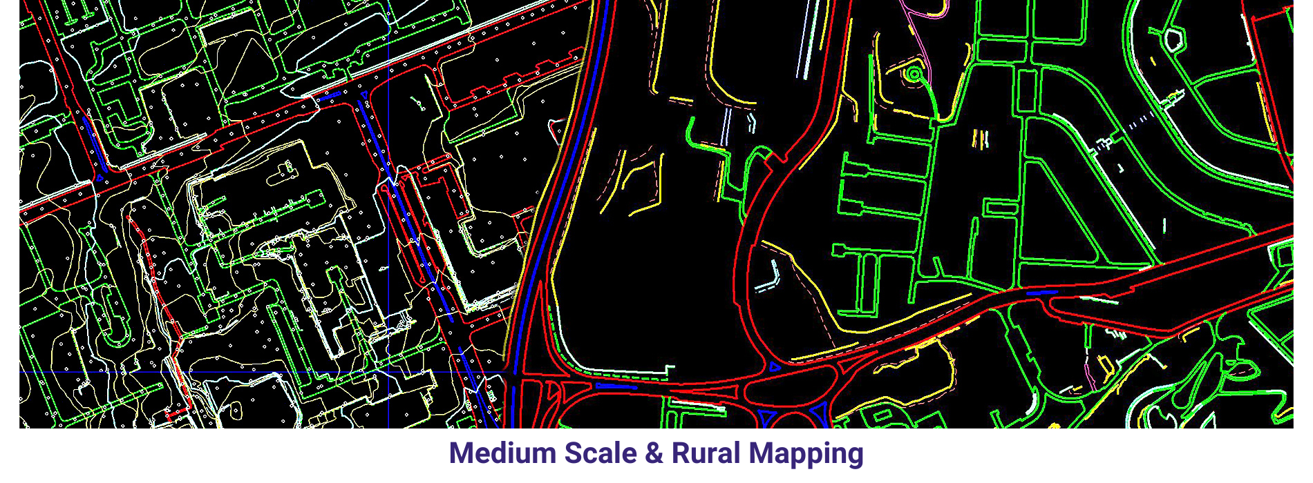
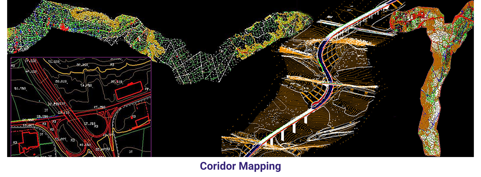
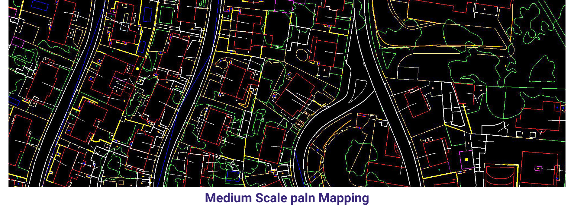
Topographic mapping
Topographic mapping involves the creation of detailed and accurate representations of the Earth’s surface, depicting its elevation, contours, landforms, and other physical features. These maps provide valuable information for a wide range of applications, including urban planning, engineering design, natural resource management, environmental assessment, and outdoor recreation.
Topographic maps are essential tools for a wide range of users, including government agencies, urban planners, engineers, surveyors, hikers, and outdoor enthusiasts. They provide valuable information for planning and decision-making in diverse fields, helping to ensure the sustainable management and development of the Earth’s surface.
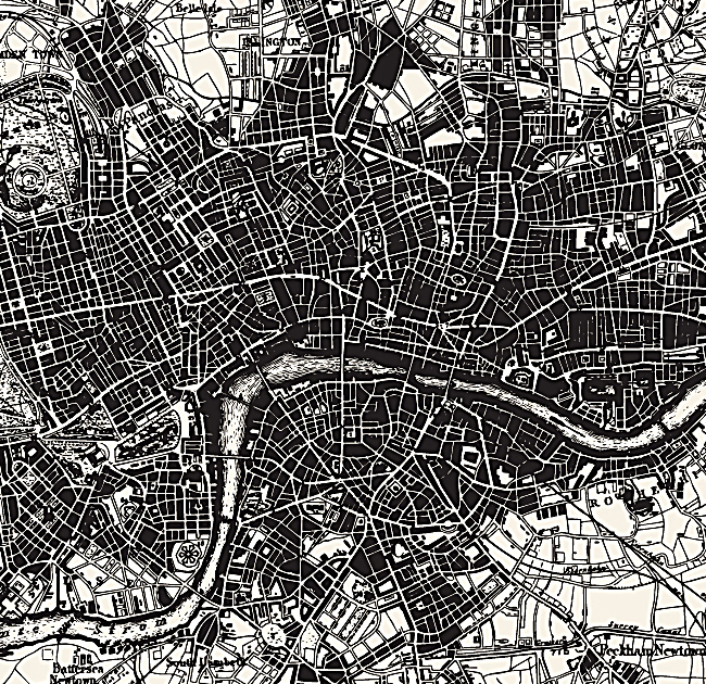
Historical mapping
Historical mapping involves the creation of maps that represent geographical features, political boundaries, cultural landmarks, and other aspects of the Earth’s surface as they existed at specific points in the past. These maps are invaluable for understanding historical events, changes in landscapes over time, and the evolution of human societies.
Historical mapping is an interdisciplinary endeavor that draws on expertise from fields such as history, geography, archaeology, cartography, and computer science. By reconstructing past landscapes and spatial relationships, historical maps provide valuable insights into human history, cultural heritage, and the dynamics of human-environment interactions across different time periods and geographical regions.
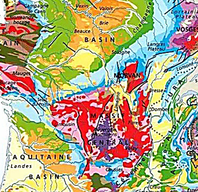
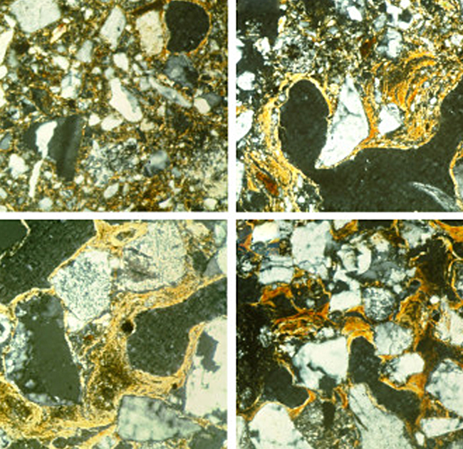
Geological mapping
Geological mapping is a fundamental aspect of geology that involves the systematic study and recording of the distribution, nature, and relationships of rock units and geological features within a specific area. It’s essentially like creating a map of the Earth’s surface, but with a focus on the types of rocks, their ages, structures, and other geological phenomena.
Geological mapping is essential for understanding the Earth’s history, predicting geological hazards, managing natural resources, and planning infrastructure projects such as roads, bridges, and buildings. It’s a key tool in the field of geology and has applications in various industries and scientific disciplines.
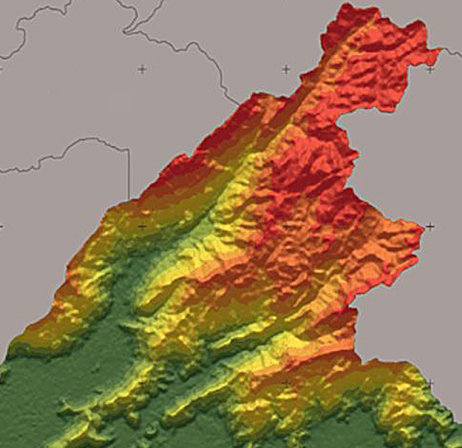
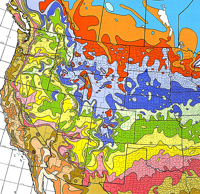
Hypsometric mapping
Hypsometric mapping, also known as elevation mapping or topographic mapping, involves representing the elevation or height of land surface features on a map. It’s a crucial aspect of cartography and is used in various fields such as geography, geology, environmental science, urban planning, and civil engineering.
Hypsometric mapping is essential for various applications, including land use planning, natural resource management, disaster risk assessment, infrastructure development, and environmental monitoring. It provides valuable insights into the morphology and dynamics of the Earth’s surface and helps in making informed decisions related to spatial planning and resource allocation.
Soil mapping
Soil mapping, also known as soil surveying or soil cartography, is the process of systematically collecting, analysing, and representing information about the distribution, properties, and classifications of soils within a specific area. It’s a crucial aspect of soil science, agriculture, land management, environmental science, and various other fields. Soil maps provide valuable information for understanding soil variability, fertility, suitability for different land uses, and potential environmental risks.
Soil mapping plays a vital role in sustainable land management practices by helping to optimize agricultural productivity, minimize environmental impacts, and support informed decision-making regarding land use and development.
Thematic mapping
Thematic mapping involves the visual representation of spatial data related to a specific theme or topic, rather than simply depicting geographic features like elevation or landforms. These maps are designed to communicate information about a particular subject or phenomenon, such as population density, land use, climate patterns, or socio-economic indicators.
Thematic mapping is widely used in fields such as geography, environmental science, urban planning, public health, economics, and the social sciences. It plays a crucial role in visualizing complex spatial data and informing decision-making processes across diverse domains.
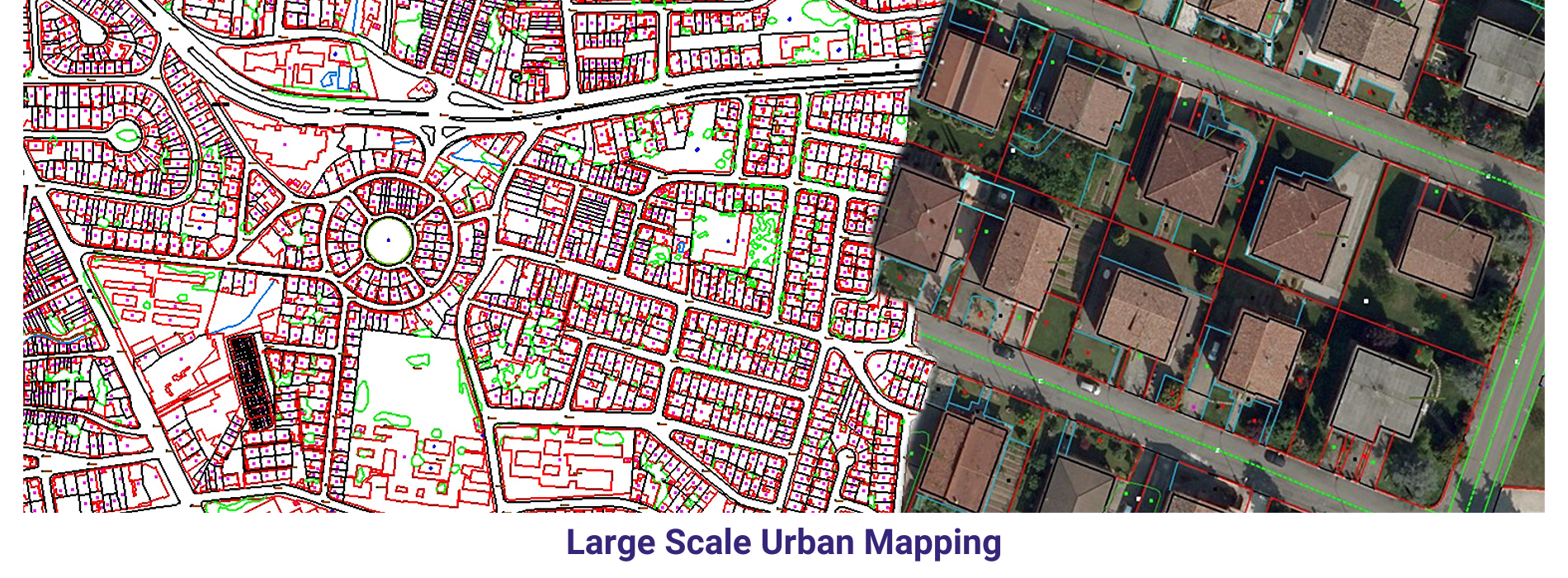
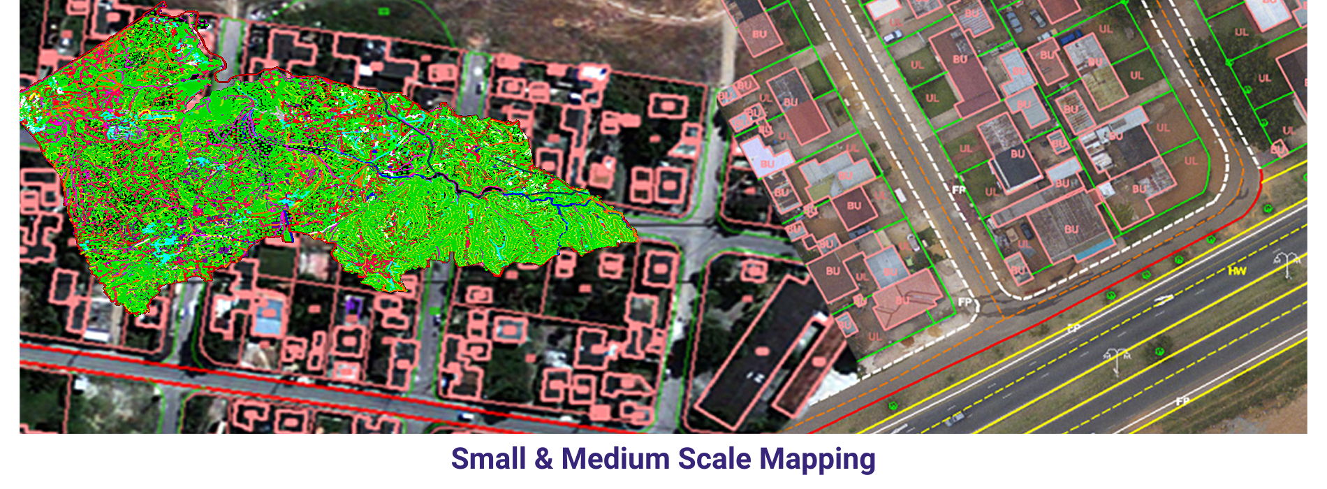
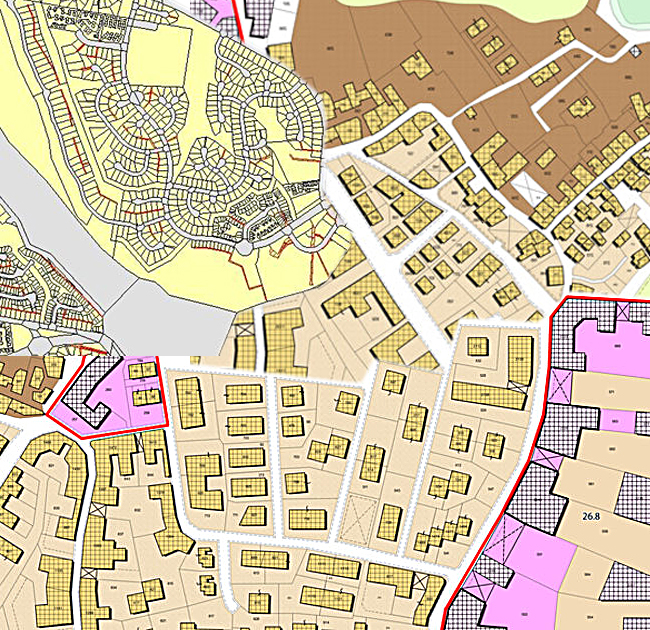
Cadastral Mapping
Cadastral mapping involves the delineation and representation of land parcel boundaries, ownership, land use, and other pertinent information related to land tenure. These maps are essential for managing land ownership, property taxation, land registration, urban planning, infrastructure development, and resource management.
Cadastral mapping plays a crucial role in supporting land governance, land tenure security, and sustainable land management practices. By providing accurate and up-to-date information about land parcels and property rights, cadastral maps help facilitate land transactions, resolve land disputes, promote investment in land development, and support equitable access to land resources.