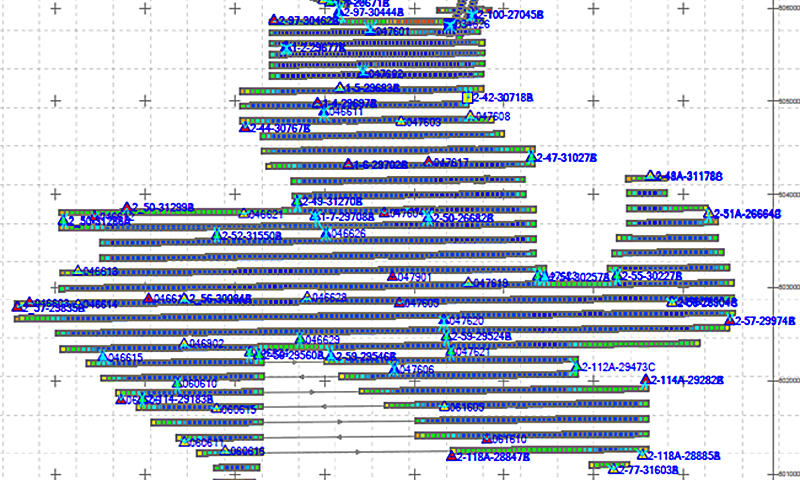
AAMGST is capable of doing Aerial Triangulation of both Aerial and Satellite imageries by using Automatic tie point extraction and manual measurement of Ground Control Points and additional tie points to produce accurate and reliable AT results.
AAMGST personnel are well acquitted with the mapping standards (ASPRS, NMAS, and NSSDA). Our dedicated team has been involved in delivering the client’s expected quality with on time delivery.
AAMGST is capable of producing wide array of high-resolution Digital Terrain models. Our strong technical team can able to produce accurate data with cost-efficient methods.
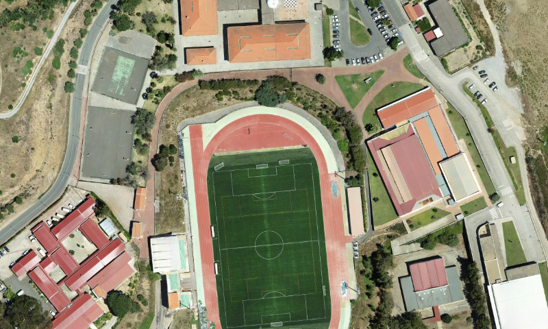
AAMGST has delivered orthophotos from aerial frames(300W) and 1.5 million Sqkm from satellite data. Orthophotos with high accuracy and radiornetically enhanced from different sensors (aerial frame, digital camera, and satellite) with various GSDs (0.08, 0.1, 0.25, 0.5 and 1 .O meters).
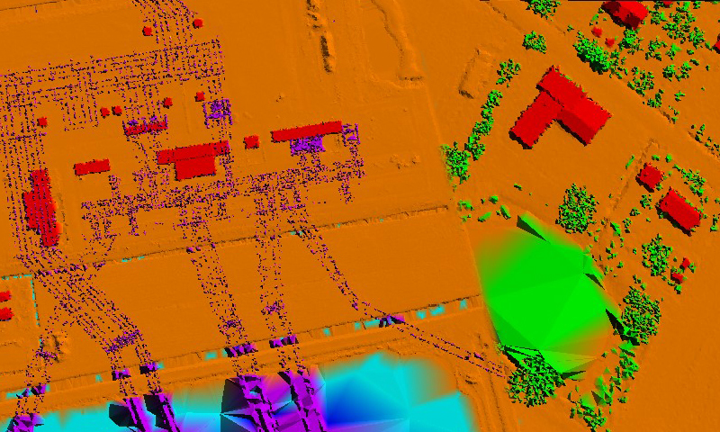
AAMGST has strong comprehensive hold on LiDAR processing of Airborne, Terrestral and Mobile data. LiDAR data has been classified and vectorized from various Scanners(Leica, RIEGL and Optech) for different applications.
AAMGST provide comprehensive spatial engineering solutions with experienced GIS Engineers. We are specialized in understanding our client’s requirements for providing better solutions on time. AMMGST has been providing the services for land use planning, airport service area analysis, site selection, and airspace obstruction analysis.
Gathering geospatial data from movable vehicles, such as cars, drones, boats, trains, or airplanes, is known as Mobile mapping. Various sensors could be installed in vehicles.
3D building modeling plays a crucial role in creating accurate and detailed representations of urban environments. Overall, 3D building modeling in the geospatial industry enhances our understanding of urban environments supports informed decision-making, and facilitates various applications ranging from urban planning and development to emergency management and beyond.