Orthophoto Generation
Orthophoto - High Resolution Multi band
The provided Digital Aerial Images have been triangulated by using provided ground control points. Inpho software has been used for triangulation of images. DTM features have been compiled as per the specifications. Orthophotos were generated using inphos software in prthomaster module.
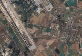
Orthophoto - Airport Area
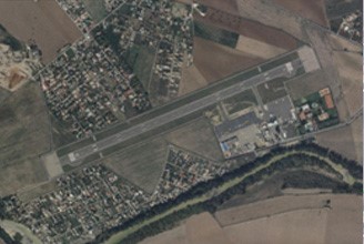
Project setup has been done with the provided aerial frame images. Ground controls have been verified in stereo for quality confirmation of block file. DTM has been generated by using the restituted terrain features.
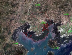
Orthophoto - Coastal Corridor
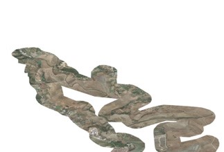
It is a coastal corridor mapping. Aerial Images from DMC camera have been triangulated by using client provided ground control points. Orthophoto mosaic tiles have been generated as per the client provided index.
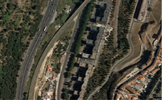
Orthophoto - Urban Area
DTM was compiled for whole project area and then orthorectification was done for 4 band images at 0.25m GSD. Final output was delivered in two sets of orthophoto mosaics RGB and Color Infrared(CIR) using compiled DTM. Final CIR Orthophoto tiles were cut into final tiles as per ortho tile index.
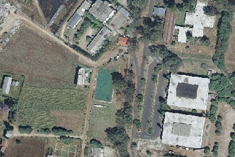
Orthophoto - Rural Area
Project setup has been done using exterior parameters and DMC images. Orthophotos have been generated using restituted terrain elements and DEM. Orthophotos have been corrected geometrically and radiometrically.
Georeferencing and orthorectification of Rapid Eye Images
Rapid Eye images(5 bands) in NTF format have been combined as single image of NFT format using Erdas. Rapid eye images were orthorectified. Final data has been delivered in two sets one RGB and other is five band images as per the AOI.