Digital Terrain Models
01AD0
The client provided Digital Aerial Images. They have been triangulated using ground control points. Once the AT results are approved by client the DTM elements have been compiled with our standard practices and by break line, mass points and streams.
12ADL0
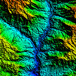
The Project consists of DTM generation from LiDAR classified data and Photogrametrically compiled stream and break lines. First of all we have classified the LiDAR point cloud data into bare earth, buildings, vegetation and default classes. Secondly the streams and break lines have been compiled using photogrammetric method.
16D0
The purpose of this project is generating Orthophoto of 0.15 GSD from stereo compiled break lines and mass points. The project setup has been done with the provided AT results and the mass points and break lines have been compiled. The quality of the data has been verified by generating TIN and surface models and in house tools.
13_103_001D0
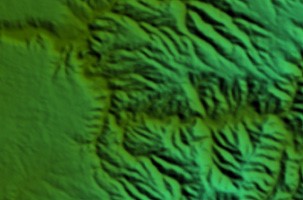
The purpose of the project is to generate orthophoto of 0.5m GSD with auto-correlated DEM. Auto DEM was generated from 4 band aerial images by using Inphos MATCH-T software and the terrain mainly consists of foresr and mountaneous area.