AAM Geo Spatial Tech Private Limited is capable of producing high resolution Digital Terrain Models. Our experienced team can able to produce accurate data with cost-efficient methods for client’s planning and decision making. AAMGST staff is expertise in placement of break lines at required place only and team skills have been upgraded as per the latest available technologies. We follow in-house developed quality check programmes and procedures to exceed the client requirement. Our photogrammetry team members are experts in manual contours. Final DTM data has been submitted in different formats line ASCII, TIN, ESRI ASCII grid and GeoTiff, Img.
We are herewith mentioned the few sample DTM projects.
| 01ADO | ||
| Project volume | : | 532608 ha |
| Scale | : | 5000 |
| Output | : | ASCII DTM /TIN model in DGN format |
Project Description :
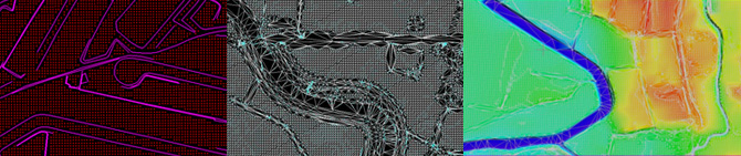
The client provided digital aerial images have been triangulated using ground control points. Once the AT results are approved by client the DTM elements have been compiled with our standard practices and by break line, mass points, streams.
The quality of the compiled DTM has been verified by using in house developed tools and also by generating the digital surface models with visual check as well.
Once the quality check is complete then the data is triangulated and exported to client required formats TIN, ASCII DEM,ESRI GRID and GeoTiff formats.
The quality of the final DTM has been cross verified with respect to the ground control points which were used in the triangulation process.
| 12ADLO | ||
| Project volume | : | 13272.56 ha |
| Scale | : | 1000 |
| Output | : | ASCII DTM (1mx1m) |
Project Description :
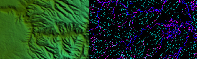
The Project consists of DTM generation from LiDAR classified data and Photogrametrically compiled stream and break lines. First of all we have classified the LiDAR point cloud data in to bare earth, building, vegetation and default classes. Secondly the steams and break lines have been compiled using photogrammetric method.
Finally DTM has been generated by combining the both the data and the quality have been verified. The data final out put has been submitted to client as per provided tiles in ASCII DTM format of grid spacing 1mx1m.
| 16DO | ||
| Project volume | : | 23200 ha |
| Scale | : | 2000 |
| Output | : | ASCII DTM (2mx2m) |
Project Description :
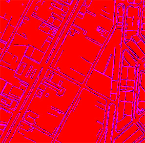
The Purpose of this project is generating Orthophoto of 0.15 GSD from stereo compiled break lines and mass points. The project setup has been done with the provided AT results and the mass points and break lines have been compiled. The quality of the data has been verified by generating TIN and surface models and in house tools.
Finally DTM has been submitted to client ASCII 2mx2m grid.

| 13_103_001DO | ||
| Project volume | : | 2883 Sq Km. |
| Scale | : | 5000 |
| Output | : | ESRI ASCII GRID 5mX5m |
Project Description :
The Purpose of the project is to generate orthophoto of 0.5m GSD with auto-correlated DEM. Auto DEM was generated from 4 band aerial images by using Inphos MATCH-T software and the terrain mainly consists of forest and mountaneous area.
The auto generated DTM has been edited by adding sufficient break lines to fit the data to terrain morphology and the software used is Inpho’s Dtmater.We also ensured the constant heights for DTM points inside the lakes and sea areas.